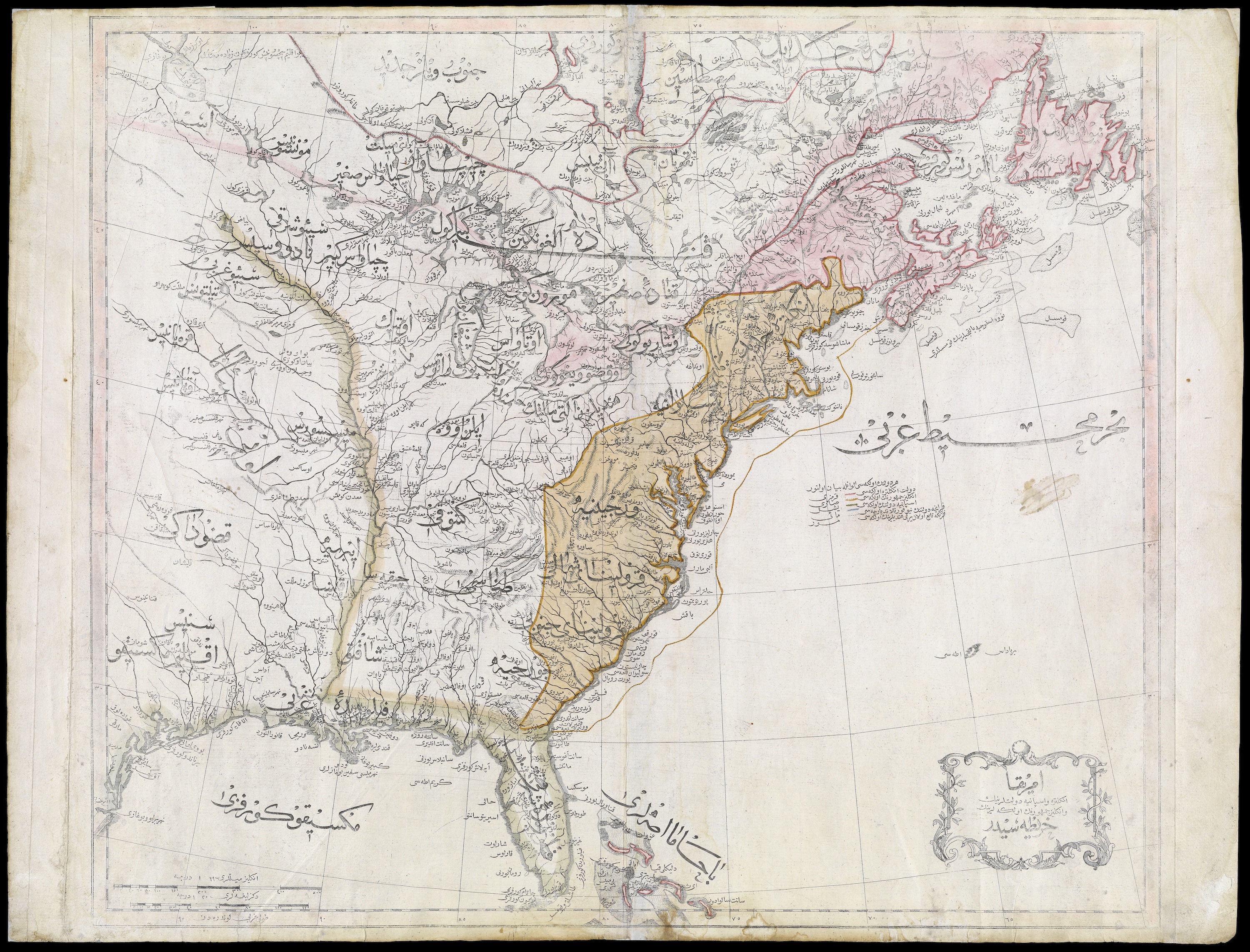
What did the United States look like to observers from the Ottoman Empire (wiki) in 1803? In this map, the newly independent U.S. is labeled “The Country of the English People” (“İngliz Cumhurunun Ülkesi”). The Iroquois Confederacy shows up as well, labeled the “Government of the Six Indian Nations.” Other tribes shown on the map include the Algonquin, Chippewa, Western Sioux (Siyu-yu Garbî), Eastern Sioux (Siyu-yu Şarkî), Black Pawnees (Kara Panis), and White Pawnees (Ak Panis).
Click here for a zoomable version, and/or visit the map's page in the digital collections of the Osher Map Library, University of Southern Maine.
 |
| Click here to embiggen |
Related:
No comments:
Post a Comment